Heading out Thursday to see grandparents? Or Friday to see friends for a festive party?
Nope. Scrap those plans.
That’s the latest word from the National Weather Service as the latest – and coldest – weather storm is bearing down on the NWCT area just in time for the holiday weekend.
 Christmas travel plans are going to be dramatically impacted, as snow, cold and high winds will make for a “life-threatening” weather situation, according to experts.
Here are the phases.
Phase 1 – Snow, sometimes heavy, arrives in Minnesota on Wednesday morning and hits the Twin Cities around the lunch hour. In all 5 to 8 inches of new powder will drop on most areas, but it’s not the snow amounts that have weather forecasters nervous. It’s what comes next.
Phase 2 – Wednesday night into Thursday, snow will taper, but the temperature will plummet. By 8 a.m. Thursday, the actual temp is forecast to be 8 degrees below zero, with the “feels like” a numbing 32 below zero. By 10 a.m., as the winds rise, that could hit 35 to 40 below.
Phase 3 – Wind, ground blizzard conditions and whiteouts west of the Wright County area. Traveling south or west? Forget it. Winds – SUSTAINED – at 40 mph with gust between 50 and 60 mph will white out areas, blow larger vehicles off roads and create black ice on bridges and culverts. This will last Thursday afternoon through Saturday.
Phase 4 – Consistent “feels like” temperatures 20 to 30 below zero through Saturday and Sunday, with a bit of a reprieve finally coming Sunday night – at 4 below.
Here’s the rundown from the NWS:
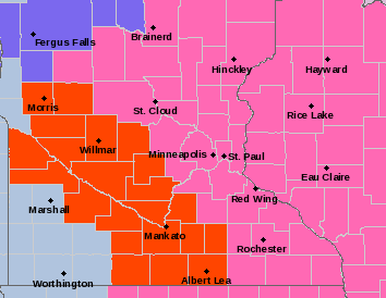
...WINTER STORM WARNING IN EFFECT FROM 6 AM WEDNESDAY TO NOON CST
THURSDAY...
...WIND CHILL WARNING REMAINS IN EFFECT FROM 6 AM THURSDAY TO
NOON CST SATURDAY...
...BLIZZARD WARNING IN EFFECT FROM NOON THURSDAY TO 6 AM CST
SATURDAY...

* WHAT...For the Winter Storm Warning, heavy snow expected.
  Total snow accumulations of 5 to 8 inches. Winds gusting as
  high as 35 mph. For the Blizzard Warning, blizzard conditions
  expected. Winds gusting as high as 50 mph. For the Wind Chill
  Warning, dangerously cold wind chills expected. Wind chills as
  low as 40 below zero.

* WHERE...Portions of central, south central, southwest and west
  central Minnesota.

* WHEN...For the Winter Storm Warning, from 6 AM Wednesday to
  noon CST Thursday. For the Blizzard Warning, from noon
  Thursday to 6 AM CST Saturday. For the Wind Chill Warning,
  from 6 AM Thursday to noon CST Saturday.

* IMPACTS...Travel could be very difficult or impossible.
  Widespread blowing snow could significantly reduce visibility.
  Gusty winds could bring down tree branches. The dangerously
  cold wind chills could cause frostbite on exposed skin in as
  little as 10 minutes.

* ADDITIONAL DETAILS...This could be a life-threatening situation
  if you get stranded traveling late this week. Consider
  adjusting any travel plans now.

PRECAUTIONARY/PREPAREDNESS ACTIONS...

Travel should be restricted to emergencies only. If you must
travel, have a winter survival kit with you. If you get stranded,
stay with your vehicle.

The latest road conditions for the state you are calling from can
be obtained by calling 5 1 1. Road conditions can also be found
at 511mn.org for Minnesota or 511wi.gov for Wisconsin.