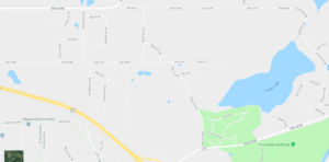
Residents and land owners from St. Michael’s northeast quadrant filled the city’s council chambers to the brim earlier this month for a meeting about how the city ought to plan for that area’s future development.

The Current Plan
The space is currently zoned agricultural, which allows for 1 dwelling unit per 40 acres. Up until 1996, when Frankfort Township was incorporated into St. Michael, Frankfort Township allowed 1 acre subdivision lots if they were contiguous to an existing subdivision. Most of this development occurred in the late 1980s through mid 1990s.
The city’s land use plan for this area calls for low-density residential with lot sizes similar to other neighborhood lots in the city, around one-quarter to one-third of an acre. The plan also requires all new residential development to be connected to city sewer and water.
Possible Plan Changes
Now, city leaders are considering changes to the land use policy for this quadrant to accommodate demand for larger lots within the city. This would allow land to be subdivided without city sewer and water, and city leadership said it could open the door for more local builders to develop the area versus the national builders that have been developing suburban-style neighborhoods around St. Michael over the past few years.
Community development director, Marc Weigle, gave three different options for future residential development in the area. Residents at the meeting could vote for either rural residential development, suburban development or open space residential.
Rural residential is similar to current development in the area and would have 1.5-2 acre lots with their own primary and secondary septic sites. Examples given at the meeting have between 18 to 28 lots per 40 acres of land and no open space or park space.
Suburban residential development is the current plan for this area. This would include approximately one-quarter of an acre lot sizes, city sewer and water, sidewalks and park space.
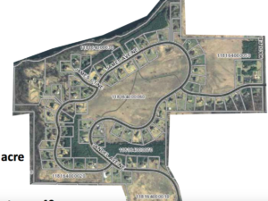
Open space developments are a bit of a combination between rural and suburban, where a neighborhood would have larger lots and more open land and green space. Lots are clustered to preserve open space and they are often served by shared community septic systems, or back-up areas are available in the open space areas. The city cited Otsego’s Mississippi Pines neighborhood off CSAH 39 as a local example of an open space development, which has 12.5 lots per 40 acres and 52 percent open space. That development has 72 lots on 230 acres.

Resident Feedback
Residents seemed fairly united in their vision for the area, though they differed on some key ideas. For instance, only 8 percent of meeting attendees voted in favor of suburban residential development in this quadrant of the city. However, they split fairly evenly between the other two options, with 45 percent supporting rural residential development and 46 percent voting for open space development.
Attendees voted by a wide margin that they do not care to have retail and commercial services in close proximity to their neighborhood, with 92 percent stating that was not important to them. Only a small minority (16 percent) voted that they’d like their home serviced with sewer and water in future years. 90 percent of attendees said they wanted wooded areas preserved as development occurs. Most wanted water quality protected or improved and for some lakeshore along Foster Lake to be preserved as public land.
This portion of St. Michael currently does not have parks and walking paths, and residents found less agreement over whether these amenities are important. Votes were evenly split when voting whether it’s important for residents to be nearby to a park. They reacted more favorably to the idea of walking paths/trails, with nearly half of attendees saying trails along collector roads are somewhat important and another 38 percent calling them very important.
Weigle said the city leaders plan to review all feedback and options for land use over the next few months and then host a public hearing before making any changes to the comprehensive plan or zoning ordinances.